

Matour topographic map
Click on the map to display elevation.
Matour
Matour is a village with a medium and low altitude. The highest point is located to the north-west in the mountain range of the Mont Saint-Cyr and reaches 769 meters of altitude, the lowest point being 328 meters. Very rugged, the village is dominated by multiple rounded mountains and capped with forests as.
About this map
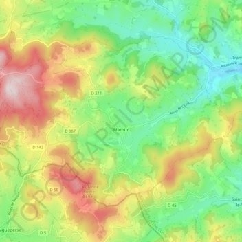
Name: Matour topographic map, elevation, terrain.
Average elevation: 1,611 ft
Minimum elevation: 1,010 ft
Maximum elevation: 2,497 ft
Other topographic maps
Click on a map to view its topography, its elevation and its terrain.
Butte à Vent
France > Bourgogne-Franche-Comté > Saône-et-Loire > Cortambert
Average elevation: 1,148 ft
La Pommeraye
France > Bourgogne-Franche-Comté > Saône-et-Loire > Beaurepaire-en-Bresse
Average elevation: 689 ft
Les Coches
France > Bourgogne-Franche-Comté > Saône-et-Loire > Chenay-le-Châtel
Average elevation: 1,004 ft