Geolocate

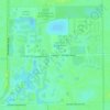
Barefoot Beach topographic map

Click on the map to display elevation.

About this map

Name: Barefoot Beach topographic map, elevation, terrain.

Location: Barefoot Beach, Collier County, Florida, 34134, United States (26.30880 -81.86370 26.34880 -81.82370)

Average elevation: 7 ft

Minimum elevation: 0 ft

Maximum elevation: 36 ft

Collier County trails, hiking, mountain biking, running and outdoor activities

Other topographic maps

Click on a map to view its topography, its elevation and its terrain.
Vineyards

United States > Florida > Collier County

Average elevation: 20 ft

Orangetree

United States > Florida > Collier County

Average elevation: 20 ft

Goodland

United States > Florida > Collier County

Average elevation: 7 ft

Naples Manor

United States > Florida > Collier County

Average elevation: 16 ft

Golden Gate

United States > Florida > Collier County

Average elevation: 16 ft

Ave Maria

United States > Florida > Collier County

Average elevation: 26 ft

Rock Creek

United States > Florida > Collier County > Naples

Average elevation: 16 ft

Baker Park

United States > Florida > Collier County > Naples

Average elevation: 16 ft

Gear up for your next adventure:

📖Nature Tracking Books - Learn to track wildlife and terrain
📻Weather Alert Radios - Stay informed of storm risks while off-the-grid
🚗GPS Dash Cams - Record your scenic drives through mountain passes and canyons
🛡️Bear Spray Outdoor - Protection in bear country hikes
📡Handheld GPS Device - Reliable handheld GPS for outdoor navigation

As an Amazon Associate, this site earns from qualifying purchases at no extra cost to you.