
Çayıroba topographic map
Interactive map
Click on the map to display elevation.
About this map
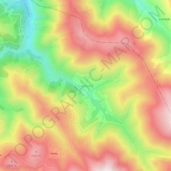
Name: Çayıroba topographic map, elevation, terrain.
Location: Çayıroba, Çaykara, Trabzon, Black Sea Region, Turkey (40.61738 40.35875 40.65738 40.39875)
Average elevation: 7,402 ft
Minimum elevation: 6,198 ft
Maximum elevation: 8,402 ft
Other topographic maps
Click on a map to view its topography, its elevation and its terrain.