
Make a donation
Gear up for your next adventure:
As an Amazon Associate, this site earns from qualifying purchases at no extra cost to you.
Vilich topographic map
Click on the map to display elevation.
Make a donation
Gear up for your next adventure:
As an Amazon Associate, this site earns from qualifying purchases at no extra cost to you.
Vilich
Ortsteile: Alt-Godesberg | Auerberg | Beuel-Mitte | Beuel-Ost | Bonn-Castell | Bonn-Zentrum | Brüser Berg | Buschdorf | Dottendorf | Dransdorf | Duisdorf | Endenich | Friesdorf | Geislar | Godesberg-Nord | Godesberg-Villenviertel | Graurheindorf | Gronau | Hardthöhe | Heiderhof | Hochkreuz | Hoholz | Holtorf | Holzlar | Ippendorf | Kessenich | Küdinghoven | Lannesdorf | Lengsdorf | Lessenich/Meßdorf | Limperich | Mehlem | Muffendorf | Nordstadt | Oberkassel | Pennenfeld | Plittersdorf | Poppelsdorf | Pützchen/Bechlinghoven | Ramersdorf | Röttgen | Rüngsdorf | Schwarzrheindorf/Vilich-Rheindorf | Schweinheim | Südstadt | Tannenbusch | Ückesdorf | Venusberg | Vilich | Vilich-Müldorf | Weststadt
Make a donation
Gear up for your next adventure:
As an Amazon Associate, this site earns from qualifying purchases at no extra cost to you.
About this map
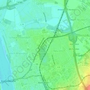
Name: Vilich topographic map, elevation, terrain.
Location: Vilich, Bonn-Beuel, Bonn, Nordrhein-Westfalen, Deutschland (50.74230 7.12211 50.75598 7.14264)
Average elevation: 190 ft
Minimum elevation: 144 ft
Maximum elevation: 295 ft
Make a donation
Gear up for your next adventure:
As an Amazon Associate, this site earns from qualifying purchases at no extra cost to you.
Other topographic maps
Click on a map to view its topography, its elevation and its terrain.
Bonn
Deutschland > Nordrhein-Westfalen > Bonn
Bonn hat seinen geografischen Mittelpunkt am Bundeskanzlerplatz, der sich im Ortsteil Gronau befindet. Die geografische Lage des Platzes ist 50° 43′ 8,8″ N, 7° 7′ 3,3″ O50.7191138888897.1175722222222. Die Bonner Innenstadt, die nicht zum Rhein hin ausgerichtet ist, liegt auf einer Höhe von 56 m bis 61 m ü. NHN.
Average elevation: 453 ft
Make a donation
Gear up for your next adventure:
As an Amazon Associate, this site earns from qualifying purchases at no extra cost to you.
Oberholtorf
Deutschland > Nordrhein-Westfalen > Bonn > Holtorf > Oberholtorf
Average elevation: 443 ft