
Thank you for supporting this site ❤️
Make a donation
Make a donation
Gear up for your next adventure:
As an Amazon Associate, this site earns from qualifying purchases at no extra cost to you.
Huaran topographic map
Click on the map to display elevation.
Thank you for supporting this site ❤️
Make a donation
Make a donation
Gear up for your next adventure:
As an Amazon Associate, this site earns from qualifying purchases at no extra cost to you.
About this map
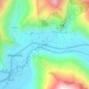
Name: Huaran topographic map, elevation, terrain.
Location: Huaran, Arin, Calca, Cusco, 08471, Perú (-13.33081 -72.03905 -13.29081 -71.99905)
Average elevation: 10,469 ft
Minimum elevation: 9,429 ft
Maximum elevation: 13,146 ft
Thank you for supporting this site ❤️
Make a donation
Make a donation
Gear up for your next adventure:
As an Amazon Associate, this site earns from qualifying purchases at no extra cost to you.