
Thank you for supporting this site ❤️
Make a donation
Make a donation
Gear up for your next adventure:
As an Amazon Associate, this site earns from qualifying purchases at no extra cost to you.
舌坡 topographic map
Click on the map to display elevation.
Thank you for supporting this site ❤️
Make a donation
Make a donation
Gear up for your next adventure:
As an Amazon Associate, this site earns from qualifying purchases at no extra cost to you.
About this map
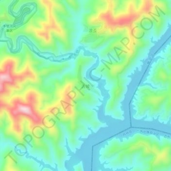
Name: 舌坡 topographic map, elevation, terrain.
Location: 舌坡, Luoping County, Qujing City, Yunnan, China (24.72398 104.49560 24.76398 104.53560)
Average elevation: 2,825 ft
Minimum elevation: 2,474 ft
Maximum elevation: 3,638 ft
Thank you for supporting this site ❤️
Make a donation
Make a donation
Gear up for your next adventure:
As an Amazon Associate, this site earns from qualifying purchases at no extra cost to you.