
Thank you for supporting this site ❤️
Make a donation
Make a donation
Gear up for your next adventure:
As an Amazon Associate, this site earns from qualifying purchases at no extra cost to you.
Shuiguan topographic map
Click on the map to display elevation.
Thank you for supporting this site ❤️
Make a donation
Make a donation
Gear up for your next adventure:
As an Amazon Associate, this site earns from qualifying purchases at no extra cost to you.
About this map
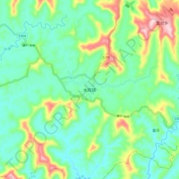
Name: Shuiguan topographic map, elevation, terrain.
Location: Shuiguan, Langzhong City, Nanchong, Sichuan, China (31.42227 106.17912 31.50227 106.25912)
Average elevation: 1,434 ft
Minimum elevation: 1,158 ft
Maximum elevation: 2,110 ft
Thank you for supporting this site ❤️
Make a donation
Make a donation
Gear up for your next adventure:
As an Amazon Associate, this site earns from qualifying purchases at no extra cost to you.