
Thank you for supporting this site ❤️
Make a donation
Make a donation
Gear up for your next adventure:
As an Amazon Associate, this site earns from qualifying purchases at no extra cost to you.
Pallon topographic map
Click on the map to display elevation.
Thank you for supporting this site ❤️
Make a donation
Make a donation
Gear up for your next adventure:
As an Amazon Associate, this site earns from qualifying purchases at no extra cost to you.
About this map
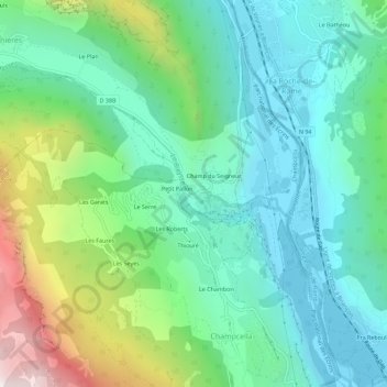
Name: Pallon topographic map, elevation, terrain.
Average elevation: 4,186 ft
Minimum elevation: 2,976 ft
Maximum elevation: 7,464 ft
Thank you for supporting this site ❤️
Make a donation
Make a donation
Gear up for your next adventure:
As an Amazon Associate, this site earns from qualifying purchases at no extra cost to you.
Other topographic maps
Click on a map to view its topography, its elevation and its terrain.
Gîte-Refuge de l’École
France > Provence-Alpes-Côte d'Azur > Hautes-Alpes > Freissinières > Dormillouse
Average elevation: 6,486 ft