
Thank you for supporting this site ❤️
Make a donation
Make a donation
Gear up for your next adventure:
As an Amazon Associate, this site earns from qualifying purchases at no extra cost to you.
Kadampur topographic map
Click on the map to display elevation.
Thank you for supporting this site ❤️
Make a donation
Make a donation
Gear up for your next adventure:
As an Amazon Associate, this site earns from qualifying purchases at no extra cost to you.
About this map
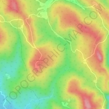
Name: Kadampur topographic map, elevation, terrain.
Location: Kadampur, Taljhari, Sahibganj (district), Jharkhand, India (25.18329 87.70951 25.19130 87.71918)
Average elevation: 709 ft
Minimum elevation: 449 ft
Maximum elevation: 919 ft
Thank you for supporting this site ❤️
Make a donation
Make a donation
Gear up for your next adventure:
As an Amazon Associate, this site earns from qualifying purchases at no extra cost to you.