
Thank you for supporting this site ❤️
Make a donation
Make a donation
Gear up for your next adventure:
As an Amazon Associate, this site earns from qualifying purchases at no extra cost to you.
Portete topographic map
Click on the map to display elevation.
Thank you for supporting this site ❤️
Make a donation
Make a donation
Gear up for your next adventure:
As an Amazon Associate, this site earns from qualifying purchases at no extra cost to you.
About this map
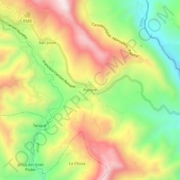
Name: Portete topographic map, elevation, terrain.
Location: Portete, Piñas, El Oro, 070401, Ecuador (-3.72057 -79.67862 -3.68057 -79.63862)
Average elevation: 3,176 ft
Minimum elevation: 2,129 ft
Maximum elevation: 4,314 ft
Thank you for supporting this site ❤️
Make a donation
Make a donation
Gear up for your next adventure:
As an Amazon Associate, this site earns from qualifying purchases at no extra cost to you.