
Thank you for supporting this site ❤️
Make a donation
Make a donation
Gear up for your next adventure:
As an Amazon Associate, this site earns from qualifying purchases at no extra cost to you.
Kelshi topographic map
Click on the map to display elevation.
Thank you for supporting this site ❤️
Make a donation
Make a donation
Gear up for your next adventure:
As an Amazon Associate, this site earns from qualifying purchases at no extra cost to you.
About this map
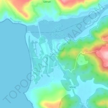
Name: Kelshi topographic map, elevation, terrain.
Location: Kelshi, Dapoli Taluka, Ratnagiri, Maharashtra, 415200, India (17.90112 73.04325 17.94112 73.08325)
Average elevation: 121 ft
Minimum elevation: -3 ft
Maximum elevation: 659 ft
Thank you for supporting this site ❤️
Make a donation
Make a donation
Gear up for your next adventure:
As an Amazon Associate, this site earns from qualifying purchases at no extra cost to you.