
Thank you for supporting this site ❤️
Make a donation
Make a donation
Gear up for your next adventure:
As an Amazon Associate, this site earns from qualifying purchases at no extra cost to you.
Brig topographic map
Click on the map to display elevation.
Thank you for supporting this site ❤️
Make a donation
Make a donation
Gear up for your next adventure:
As an Amazon Associate, this site earns from qualifying purchases at no extra cost to you.
About this map
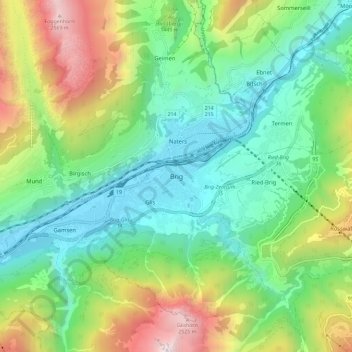
Name: Brig topographic map, elevation, terrain.
Location: Brig, Brig-Glis, Brig, Wallis, 3900, Switzerland (46.27635 7.94795 46.35635 8.02795)
Average elevation: 4,245 ft
Minimum elevation: 2,142 ft
Maximum elevation: 8,743 ft
Thank you for supporting this site ❤️
Make a donation
Make a donation
Gear up for your next adventure:
As an Amazon Associate, this site earns from qualifying purchases at no extra cost to you.