
Thank you for supporting this site ❤️
Make a donation
Make a donation
Gear up for your next adventure:
As an Amazon Associate, this site earns from qualifying purchases at no extra cost to you.
Herisau topographic map
Click on the map to display elevation.
Thank you for supporting this site ❤️
Make a donation
Make a donation
Gear up for your next adventure:
As an Amazon Associate, this site earns from qualifying purchases at no extra cost to you.
About this map
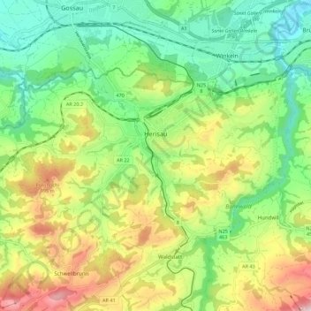
Name: Herisau topographic map, elevation, terrain.
Location: Herisau, Hinterland, Appenzell Ausserrhoden, Switzerland (47.35960 9.21873 47.40125 9.32794)
Average elevation: 2,579 ft
Minimum elevation: 1,883 ft
Maximum elevation: 3,753 ft
Thank you for supporting this site ❤️
Make a donation
Make a donation
Gear up for your next adventure:
As an Amazon Associate, this site earns from qualifying purchases at no extra cost to you.