Geolocate

Barrmill topographic map

Click on the map to display elevation.

About this map

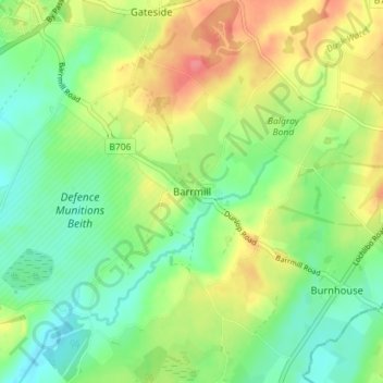
Name: Barrmill topographic map, elevation, terrain.

Location: Barrmill, North Ayrshire, Scotland, KA15 1HP, United Kingdom (55.70912 -4.62144 55.74912 -4.58144)

Average elevation: 328 ft

Minimum elevation: 240 ft

Maximum elevation: 453 ft

Gear up for your next adventure:

🌐World Map Poster - Decorative world maps with topographic info
🎒Outdoor Daypacks - Lightweight backpacks designed for carrying maps and essential gear
📶Vehicle Signal Boosters - Improve reception in rural areas while driving to trailheads
🌡️Portable Weather Meter - Track weather conditions on the trail
🏥Hiking First Aid Kits - Comprehensive medical kits for remote trail injuries

As an Amazon Associate, this site earns from qualifying purchases at no extra cost to you.