Geolocate

Rosemère topographic map

Click on the map to display elevation.

About this map

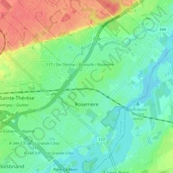
Name: Rosemère topographic map, elevation, terrain.

Location: Rosemère, Thérèse-De Blainville, Laurentides, Quebec, Canada (45.61092 -73.82855 45.66467 -73.76793)

Average elevation: 121 ft

Minimum elevation: 56 ft

Maximum elevation: 246 ft

Gear up for your next adventure:

🧺Microfiber Travel Towels - Compact and fast-drying towels for trail use
🛠️Backpacking Tool Kit - Essential toolkit for outdoor repairs
🪶Camping Sleeping Pad - Comfortable sleeping pad for backpacking
🩳Quick‑Dry Hiking Shorts - Comfortable and quick‑dry shorts for summer hiking
🛶Inflatable Kayak - Portable kayak for rivers, lakes, and expeditions

As an Amazon Associate, this site earns from qualifying purchases at no extra cost to you.