
Thank you for supporting this site ❤️
Make a donation
Make a donation
Gear up for your next adventure:
As an Amazon Associate, this site earns from qualifying purchases at no extra cost to you.
Naini topographic map
Click on the map to display elevation.
Thank you for supporting this site ❤️
Make a donation
Make a donation
Gear up for your next adventure:
As an Amazon Associate, this site earns from qualifying purchases at no extra cost to you.
About this map
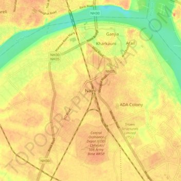
Name: Naini topographic map, elevation, terrain.
Location: Naini, Karchhana, Prayagraj, Uttar Pradesh, 211008, India (25.36289 81.82289 25.44289 81.90289)
Average elevation: 292 ft
Minimum elevation: 207 ft
Maximum elevation: 344 ft
Thank you for supporting this site ❤️
Make a donation
Make a donation
Gear up for your next adventure:
As an Amazon Associate, this site earns from qualifying purchases at no extra cost to you.