
Thank you for supporting this site ❤️
Make a donation
Make a donation
Gear up for your next adventure:
As an Amazon Associate, this site earns from qualifying purchases at no extra cost to you.
Máze - Masi topographic map
Click on the map to display elevation.
Thank you for supporting this site ❤️
Make a donation
Make a donation
Gear up for your next adventure:
As an Amazon Associate, this site earns from qualifying purchases at no extra cost to you.
About this map
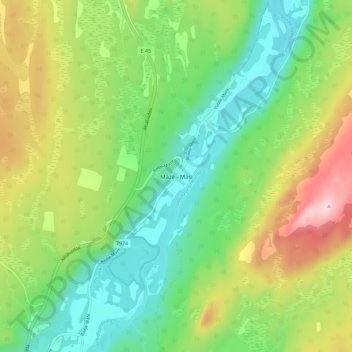
Name: Máze - Masi topographic map, elevation, terrain.
Location: Máze - Masi, Kautokeino, Troms og Finnmark, 9525, Norway (69.42376 23.64707 69.46376 23.68707)
Average elevation: 1,165 ft
Minimum elevation: 840 ft
Maximum elevation: 1,729 ft
Thank you for supporting this site ❤️
Make a donation
Make a donation
Gear up for your next adventure:
As an Amazon Associate, this site earns from qualifying purchases at no extra cost to you.
Other topographic maps
Click on a map to view its topography, its elevation and its terrain.