
Thank you for supporting this site ❤️
Make a donation
Make a donation
Gear up for your next adventure:
As an Amazon Associate, this site earns from qualifying purchases at no extra cost to you.
Alqueva topographic map
Click on the map to display elevation.
Thank you for supporting this site ❤️
Make a donation
Make a donation
Gear up for your next adventure:
As an Amazon Associate, this site earns from qualifying purchases at no extra cost to you.
About this map
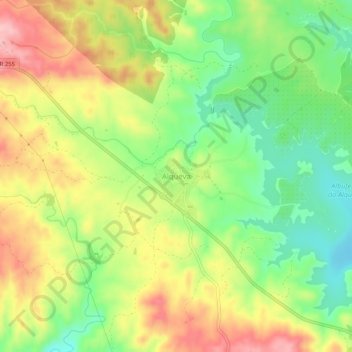
Name: Alqueva topographic map, elevation, terrain.
Location: Alqueva, Amieira e Alqueva, Portel, Évora, 7220-028, Portugal (38.19694 -7.55951 38.23694 -7.51951)
Average elevation: 627 ft
Minimum elevation: 381 ft
Maximum elevation: 909 ft
Thank you for supporting this site ❤️
Make a donation
Make a donation
Gear up for your next adventure:
As an Amazon Associate, this site earns from qualifying purchases at no extra cost to you.