
Make a donation
Gear up for your next adventure:
As an Amazon Associate, this site earns from qualifying purchases at no extra cost to you.
Buena topographic map
Click on the map to display elevation.
Make a donation
Gear up for your next adventure:
As an Amazon Associate, this site earns from qualifying purchases at no extra cost to you.
About this map
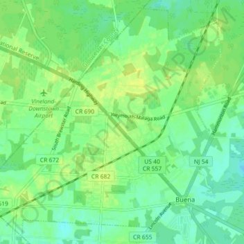
Name: Buena topographic map, elevation, terrain.
Location: Buena, Atlantic County, New Jersey, United States (39.50547 -74.98522 39.55653 -74.91433)
Average elevation: 108 ft
Minimum elevation: 82 ft
Maximum elevation: 131 ft
Atlantic County trails, hiking, mountain biking, running and outdoor activities
Make a donation
Gear up for your next adventure:
As an Amazon Associate, this site earns from qualifying purchases at no extra cost to you.
Other topographic maps
Click on a map to view its topography, its elevation and its terrain.
Absecon Highlands
United States > New Jersey > Atlantic County > Galloway Township
Average elevation: 26 ft
Make a donation
Gear up for your next adventure:
As an Amazon Associate, this site earns from qualifying purchases at no extra cost to you.
Brigantine
United States > New Jersey > Atlantic County > Brigantine > Brigantine
Average elevation: 0 ft
Egg Harbor Township
United States > New Jersey > Atlantic County > Egg Harbor Township
Average elevation: 43 ft
Make a donation
Gear up for your next adventure:
As an Amazon Associate, this site earns from qualifying purchases at no extra cost to you.