
Thank you for supporting this site ❤️
Make a donation
Make a donation
Gear up for your next adventure:
As an Amazon Associate, this site earns from qualifying purchases at no extra cost to you.
Poyeni topographic map
Click on the map to display elevation.
Thank you for supporting this site ❤️
Make a donation
Make a donation
Gear up for your next adventure:
As an Amazon Associate, this site earns from qualifying purchases at no extra cost to you.
About this map
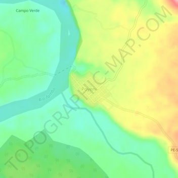
Name: Poyeni topographic map, elevation, terrain.
Location: Poyeni, Río Tambo, Satipo, Junín, Perú (-11.27616 -73.68849 -11.23616 -73.64849)
Average elevation: 938 ft
Minimum elevation: 787 ft
Maximum elevation: 1,175 ft
Thank you for supporting this site ❤️
Make a donation
Make a donation
Gear up for your next adventure:
As an Amazon Associate, this site earns from qualifying purchases at no extra cost to you.