
Thank you for supporting this site ❤️
Make a donation
Make a donation
Gear up for your next adventure:
As an Amazon Associate, this site earns from qualifying purchases at no extra cost to you.
Pedregal topographic map
Click on the map to display elevation.
Thank you for supporting this site ❤️
Make a donation
Make a donation
Gear up for your next adventure:
As an Amazon Associate, this site earns from qualifying purchases at no extra cost to you.
About this map
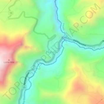
Name: Pedregal topographic map, elevation, terrain.
Location: Pedregal, Imués, La Sabana, Nariño, RAP Pacífico, Colombia (1.03047 -77.47329 1.07047 -77.43329)
Average elevation: 6,732 ft
Minimum elevation: 5,272 ft
Maximum elevation: 9,131 ft
Thank you for supporting this site ❤️
Make a donation
Make a donation
Gear up for your next adventure:
As an Amazon Associate, this site earns from qualifying purchases at no extra cost to you.