
夫子庙 topographic map
Interactive map
Click on the map to display elevation.
About this map
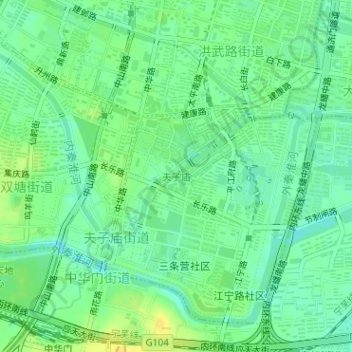
Name: 夫子庙 topographic map, elevation, terrain.
Location: 夫子庙, 夫子庙街道, 秦淮区, 南京市, 江苏省, 中国 (32.01506 118.77746 32.02567 118.78970)
Average elevation: 46 ft
Minimum elevation: 13 ft
Maximum elevation: 85 ft
Other topographic maps
Click on a map to view its topography, its elevation and its terrain.