
Thank you for supporting this site ❤️
Make a donation
Make a donation
Gear up for your next adventure:
As an Amazon Associate, this site earns from qualifying purchases at no extra cost to you.
Kopili topographic map
Click on the map to display elevation.
Thank you for supporting this site ❤️
Make a donation
Make a donation
Gear up for your next adventure:
As an Amazon Associate, this site earns from qualifying purchases at no extra cost to you.
About this map
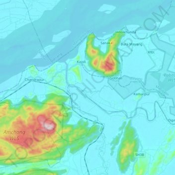
Name: Kopili topographic map, elevation, terrain.
Location: Kopili, Sonapur, Kamrup Metropolitan, Assam, 781050, India (26.19529 91.89888 26.26021 92.07218)
Average elevation: 331 ft
Minimum elevation: 141 ft
Maximum elevation: 1,821 ft
Thank you for supporting this site ❤️
Make a donation
Make a donation
Gear up for your next adventure:
As an Amazon Associate, this site earns from qualifying purchases at no extra cost to you.