
Thank you for supporting this site ❤️
Make a donation
Make a donation
Gear up for your next adventure:
As an Amazon Associate, this site earns from qualifying purchases at no extra cost to you.
Mae Sot topographic map
Click on the map to display elevation.
Thank you for supporting this site ❤️
Make a donation
Make a donation
Gear up for your next adventure:
As an Amazon Associate, this site earns from qualifying purchases at no extra cost to you.
About this map
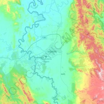
Name: Mae Sot topographic map, elevation, terrain.
Location: Mae Sot, Mae Tao, Mae Sot, Tak Province, 63110, Thailand (16.55499 98.40955 16.87499 98.72955)
Average elevation: 1,112 ft
Minimum elevation: 558 ft
Maximum elevation: 3,018 ft
Thank you for supporting this site ❤️
Make a donation
Make a donation
Gear up for your next adventure:
As an Amazon Associate, this site earns from qualifying purchases at no extra cost to you.
Other topographic maps
Click on a map to view its topography, its elevation and its terrain.