Geolocate

Knuckles topographic map

Click on the map to display elevation.

About this map

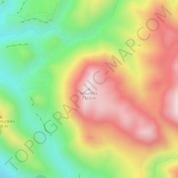
Name: Knuckles topographic map, elevation, terrain.

Location: Knuckles, Selwyn District, Canterbury, New Zealand (-43.23755 171.58400 -43.23745 171.58410)

Average elevation: 3,215 ft

Minimum elevation: 2,162 ft

Maximum elevation: 4,308 ft

Gear up for your next adventure:

🔦LED Headlamp - Bright and durable LED headlamp for night navigation
🥾Men's Hiking Boots - Durable, waterproof footwear for rugged terrain and steep inclines
🕶️GPS Smartphone Mount - Secure mount for phone navigation
🚪Portable Camp Chair - Foldable chair for comfort at camp
🔭Telescopic Hiking Pole - Adjustable pole for hiking stability

As an Amazon Associate, this site earns from qualifying purchases at no extra cost to you.