
Hebron topographic map
Interactive map
Click on the map to display elevation.
About this map
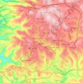
Name: Hebron topographic map, elevation, terrain.
Location: Hebron, Area H1, West Bank, 150, Palestinian Territory (31.49552 35.03433 31.56504 35.12208)
Average elevation: 2,956 ft
Minimum elevation: 2,270 ft
Maximum elevation: 3,343 ft
Other topographic maps
Click on a map to view its topography, its elevation and its terrain.
Hebron
Palestinian Territory > Area H1 > Hebron
Hebron, Area H1, West Bank, 9020000, Palestinian Territory
Average elevation: 2,077 ft