
Terrebonne topographic map
Interactive map
Click on the map to display elevation.
About this map
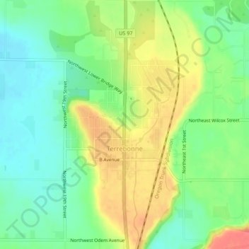
Name: Terrebonne topographic map, elevation, terrain.
Location: Terrebonne, Deschutes County, Oregon, 97760, United States (44.34057 -121.18902 44.37046 -121.15853)
Average elevation: 2,805 ft
Minimum elevation: 2,720 ft
Maximum elevation: 2,920 ft
Deschutes County trails, hiking, mountain biking, running and outdoor activities
Other topographic maps
Click on a map to view its topography, its elevation and its terrain.
Smith Rock State Park
United States > Oregon > Deschutes County > Terrebonne
Average elevation: 2,871 ft