
Thank you for supporting this site ❤️
Make a donation
Make a donation
Gear up for your next adventure:
As an Amazon Associate, this site earns from qualifying purchases at no extra cost to you.
Magalhã topographic map
Click on the map to display elevation.
Thank you for supporting this site ❤️
Make a donation
Make a donation
Gear up for your next adventure:
As an Amazon Associate, this site earns from qualifying purchases at no extra cost to you.
About this map
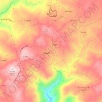
Name: Magalhã topographic map, elevation, terrain.
Location: Magalhã, Andrães, Vila Real, 5000-034, Portugal (41.22109 -7.67488 41.26109 -7.63488)
Average elevation: 1,949 ft
Minimum elevation: 1,037 ft
Maximum elevation: 2,362 ft
Thank you for supporting this site ❤️
Make a donation
Make a donation
Gear up for your next adventure:
As an Amazon Associate, this site earns from qualifying purchases at no extra cost to you.