
Thank you for supporting this site ❤️
Make a donation
Make a donation
Gear up for your next adventure:
As an Amazon Associate, this site earns from qualifying purchases at no extra cost to you.
Baeza topographic map
Click on the map to display elevation.
Thank you for supporting this site ❤️
Make a donation
Make a donation
Gear up for your next adventure:
As an Amazon Associate, this site earns from qualifying purchases at no extra cost to you.
About this map
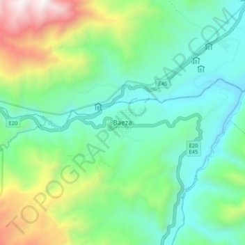
Name: Baeza topographic map, elevation, terrain.
Location: Baeza, Cantón Quijos, Napo, 150750, Ecuador (-0.50340 -77.92992 -0.42340 -77.84992)
Average elevation: 7,073 ft
Minimum elevation: 5,423 ft
Maximum elevation: 11,365 ft
Thank you for supporting this site ❤️
Make a donation
Make a donation
Gear up for your next adventure:
As an Amazon Associate, this site earns from qualifying purchases at no extra cost to you.