
Make a donation
Gear up for your next adventure:
As an Amazon Associate, this site earns from qualifying purchases at no extra cost to you.
Barqa' Samur topographic map
Click on the map to display elevation.
Make a donation
Gear up for your next adventure:
As an Amazon Associate, this site earns from qualifying purchases at no extra cost to you.
About this map
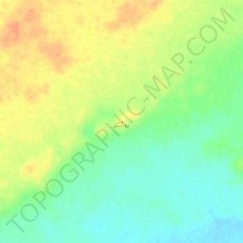
Name: Barqa' Samur topographic map, elevation, terrain.
Average elevation: 591 ft
Minimum elevation: 512 ft
Maximum elevation: 663 ft
Make a donation
Gear up for your next adventure:
As an Amazon Associate, this site earns from qualifying purchases at no extra cost to you.
Other topographic maps
Click on a map to view its topography, its elevation and its terrain.
Al Aziziyah 1st District
Saudi Arabia > Eastern Province > Al Ahsa Governorate
Average elevation: 495 ft
Al Aziziyah 2nd District
Saudi Arabia > Eastern Province > Al Ahsa Governorate
Average elevation: 492 ft
Al Qarah Mountain
Saudi Arabia > Eastern Province > Al Ahsa Governorate > الدالوة
Average elevation: 466 ft
Make a donation
Gear up for your next adventure:
As an Amazon Associate, this site earns from qualifying purchases at no extra cost to you.