
Daingerfield topographic map
Click on the map to display elevation.
About this map
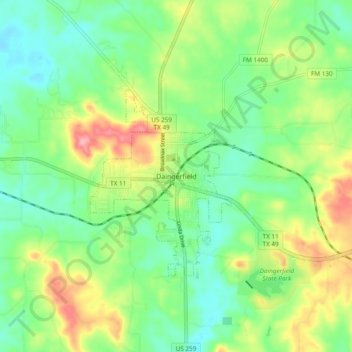
Name: Daingerfield topographic map, elevation, terrain.
Location: Daingerfield, Morris County, Texas, 75638, United States (32.99180 -94.76199 33.07180 -94.68199)
Average elevation: 390 ft
Minimum elevation: 259 ft
Maximum elevation: 623 ft
Morris County trails, hiking, mountain biking, running and outdoor activities