
Make a donation
Gear up for your next adventure:
As an Amazon Associate, this site earns from qualifying purchases at no extra cost to you.
Capulin topographic map
Click on the map to display elevation.
Make a donation
Gear up for your next adventure:
As an Amazon Associate, this site earns from qualifying purchases at no extra cost to you.
About this map
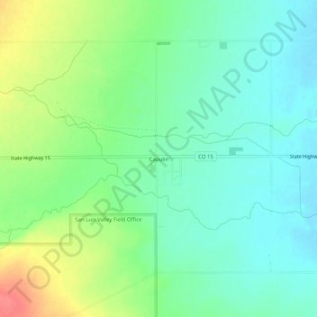
Name: Capulin topographic map, elevation, terrain.
Location: Capulin, Conejos County, Colorado, 81124, United States (37.26322 -106.13073 37.30322 -106.09073)
Average elevation: 7,831 ft
Minimum elevation: 7,759 ft
Maximum elevation: 7,976 ft
Conejos County trails, hiking, mountain biking, running and outdoor activities
Make a donation
Gear up for your next adventure:
As an Amazon Associate, this site earns from qualifying purchases at no extra cost to you.
Other topographic maps
Click on a map to view its topography, its elevation and its terrain.
Manassa
United States > Colorado > Conejos County
Manassa's elevation is 7,683 feet (2,342 m) above sea level. The land within Manassa city limits is entirely flat, with rolling hills nearby. Foothills and mountains (taller than 14,000 feet (4,300 m)) are farther in each direction, including the Sangre de Cristo Range to the east and the San Juan Mountains to…
Average elevation: 7,690 ft
Make a donation
Gear up for your next adventure:
As an Amazon Associate, this site earns from qualifying purchases at no extra cost to you.