Geolocate

Tyrolean topographic map

Click on the map to display elevation.

About this map

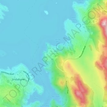
Name: Tyrolean topographic map, elevation, terrain.

Location: Tyrolean, East Jindabyne, Snowy Monaro Regional Council, New South Wales, 2627, Australia (-36.42751 148.61636 -36.38751 148.65636)

Average elevation: 3,123 ft

Minimum elevation: 2,943 ft

Maximum elevation: 3,720 ft

Other topographic maps

Click on a map to view its topography, its elevation and its terrain.

Sydney

Australia > New South Wales

Sydney's topography is characterized by a diverse landscape that seamlessly blends coastal features with inland plateaus. The city is divided into two primary regions: the relatively flat Cumberland Plain to the south and west of Sydney Harbour, and the elevated Hornsby Plateau to the north. The Cumberland…

Average elevation: 174 ft

Newcastle

Australia > New South Wales

Average elevation: 16 ft

Orange

Australia > New South Wales

Orange is a city in the Central Tablelands region of New South Wales, Australia. It is 254 km (158 mi) west of the state capital, Sydney [206 km (128 mi) on a great circle], at an altitude of 862 metres (2,828 ft). Orange had an estimated urban population of 40,493 as of June 2018 making the city a significant…

Average elevation: 2,795 ft

Northern Beaches

Australia > New South Wales > Sydney

Average elevation: 220 ft

North Sydney

Australia > New South Wales > Sydney

Average elevation: 164 ft

Goulburn

Australia > New South Wales

Owing to its elevation, Goulburn has an oceanic climate (Cfb) with warm summers and cool winters; with a high diurnal range. Its climate is variable much of the year, though generally dry with maximum temperatures ranging from 11.8 °C (53.2 °F) in July to 28.3 °C (82.9 °F) in January. Rainfall is…

Average elevation: 2,185 ft

Bowral

Australia > New South Wales

Average elevation: 2,264 ft

Port Macquarie

Australia > New South Wales

Average elevation: 16 ft

Maroubra

Australia > New South Wales

Average elevation: 89 ft

Blue Mountains

Australia > New South Wales

A sandstone plateau dominated by a landscape of endless eucalyptus forests, the Blue Mountains are located at the top of a 470-million-year-old quartzite. In the Permian period, a shallow sea covered the region, when rivers brought shales, siltstones and mudstones. Then during the Mesozoic period, rivers…

Average elevation: 1,857 ft

Wingham

Australia > New South Wales

Average elevation: 154 ft

Rutherford

Australia > New South Wales

Average elevation: 75 ft

Ku-ring-gai Chase National Park

Australia > New South Wales > Sydney

Ku-ring-gai Chase is part of the Hornsby Plateau, a massive block of sandstone tilting upwards to the north. The park comprises a plateau with an elevation of generally 150–200 m above sea level. Between 250 and 200 million years ago, sand silt and mud was deposited by rivers across flood plains. These…

Average elevation: 272 ft

Penrith

Australia > New South Wales > Sydney > Penrith

Penrith is a city in New South Wales, Australia, located in Greater Western Sydney, 55 kilometres (31 mi) west of the Sydney central business district on the banks of the Nepean River, on the outskirts of the Cumberland Plain. Its elevation is 32 metres (105 ft).

Average elevation: 112 ft

Captains Flat

Australia > New South Wales

Average elevation: 3,140 ft

Sydney

Australia > New South Wales > Sydney

Average elevation: 75 ft

Canyonleigh

Australia > New South Wales

Average elevation: 2,083 ft

Urunga

Australia > New South Wales

Average elevation: 43 ft

Baulkham Hills

Australia > New South Wales

Average elevation: 305 ft

Chatswood

Australia > New South Wales

Average elevation: 266 ft

Glen Innes

Australia > New South Wales

Average elevation: 3,553 ft

Riverstone

Australia > New South Wales

Average elevation: 85 ft

New Lambton Heights

Australia > New South Wales

Average elevation: 200 ft

Gooandra

Australia > New South Wales

Average elevation: 4,393 ft

Nowra Hill

Australia > New South Wales

Average elevation: 276 ft

East Branxton

Australia > New South Wales

Average elevation: 164 ft

Cornwallis

Australia > New South Wales

Average elevation: 33 ft

Wilsons River

Australia > New South Wales

Average elevation: 276 ft

Kiandra

Australia > New South Wales

Average elevation: 4,698 ft

Carlingford

Australia > New South Wales > Sydney

Average elevation: 322 ft

Katoomba

Australia > New South Wales

Average elevation: 2,966 ft

Byron Bay

Australia > New South Wales

Byron Bay, located in northeastern New South Wales, Australia, is characterized by diverse topography shaped by its geological history. The town is part of the erosion caldera of the ancient Tweed Volcano, which erupted approximately 23 million years ago, resulting in the rich volcanic soils that define the…

Average elevation: 23 ft

Kosciuszko National Park

Australia > New South Wales

Average elevation: 2,897 ft

Manly

Australia > New South Wales

Average elevation: 56 ft

Cronulla

Australia > New South Wales > Sydney

Average elevation: 26 ft

Marsden Park

Australia > New South Wales > Sydney

Average elevation: 102 ft

Kincumber

Australia > New South Wales > Gosford

Average elevation: 121 ft

Armidale

Australia > New South Wales

Average elevation: 3,399 ft

Lismore City Council

Australia > New South Wales

Average elevation: 272 ft

Georges Hall

Australia > New South Wales > Sydney

Average elevation: 56 ft

Pyrmont

Australia > New South Wales > Sydney

Average elevation: 59 ft

Talbingo

Australia > New South Wales

Average elevation: 2,428 ft

North Rocks

Australia > New South Wales

Average elevation: 262 ft

Central Mangrove

Australia > New South Wales

Average elevation: 860 ft

Grose Valley

Australia > New South Wales > Blackheath

The bulk of the vegetation in the wilderness is dry open forest and woodland, dominated by Eucalyptus sieberi and E. piperita above 800 metres (2,600 ft) altitude with Eucalyptus oblonga, E. globoidea, E. agglomerata and Angophora costata becoming dominant at lower altitudes. Plateau areas have thinner or…

Average elevation: 2,733 ft

Scotland Island

Australia > New South Wales > Sydney

Average elevation: 56 ft

Singleton Council

Australia > New South Wales

Average elevation: 781 ft

Paddington

Australia > New South Wales

Paddington is a rare and largely intact example of an early Victorian residential suburb. Its unique qualities may be attributed to its close proximity to the city, the topography of its harbour location, the process of development and subdivision of early land grants, and the short period in the late l9thC in…

Average elevation: 138 ft

Casino

Australia > New South Wales

Average elevation: 105 ft

Lithgow City Council

Australia > New South Wales

Average elevation: 2,339 ft

Nowra

Australia > New South Wales

Average elevation: 69 ft

St Ives

Australia > New South Wales

Average elevation: 410 ft

Blackheath

Australia > New South Wales

Blackheath (postcode: 2785) is an Australian town located near the highest point of the Blue Mountains, between Katoomba and Mount Victoria in New South Wales. The town's altitude is about 1,065 metres (3,494 ft) AHD  and it is located about 120 kilometres (75 mi) west north-west of Sydney, 11 kilometres…

Average elevation: 2,930 ft

Pittwater

Australia > New South Wales

Average elevation: 148 ft

Berowra

Australia > New South Wales > Sydney

Berowra is located 44 kilometres north of the Sydney CBD and lies at an altitude of 215 metres. Surrounded by bushland, it borders the national parks of both the Berowra Valley and Ku-ring-gai Chase.

Average elevation: 472 ft

Coogee

Australia > New South Wales

Average elevation: 115 ft

Rose Bay

Australia > New South Wales

Average elevation: 102 ft

Eden

Australia > New South Wales

Average elevation: 180 ft

Bellingen Shire Council

Australia > New South Wales

Average elevation: 1,575 ft

Wauchope

Australia > New South Wales

Average elevation: 105 ft

Lake Cathie

Australia > New South Wales

Average elevation: 20 ft

Tocumwal

Australia > New South Wales

Average elevation: 367 ft

Crookwell

Australia > New South Wales

Crookwell is a small town located in the Southern Tablelands of New South Wales, Australia, in the Upper Lachlan Shire. At the 2016 census, Crookwell had a population of 2,641. The town is at a relatively high altitude of 887 metres and there are several snowfalls during the winter months. The nearest major…

Average elevation: 2,966 ft

Tantangara Reservoir

Australia > New South Wales

Average elevation: 4,186 ft

Michelago

Australia > New South Wales

Michelago is situated in a valley between two mountain ranges, the Tinderry Range to the East and the Clear Range to the west. The Tinderry Road crosses the Tinderry range from Michelago, leading ultimately to the 1950s silver mining settlement Captains Flat. The highest peaks in the picturesque Tinderry Range…

Average elevation: 3,143 ft

Braidwood

Australia > New South Wales

Average elevation: 2,211 ft

Cabarita Beach

Australia > New South Wales

Average elevation: 30 ft

Mount Fairy

Australia > New South Wales

Average elevation: 2,516 ft

Bonville

Australia > New South Wales

Average elevation: 197 ft

Royalla

Australia > New South Wales

Average elevation: 2,684 ft

Singleton

Australia > New South Wales

Average elevation: 138 ft

Gulgong

Australia > New South Wales

Average elevation: 1,490 ft

Cassilis

Australia > New South Wales

Average elevation: 1,837 ft

Bemboka

Australia > New South Wales

Average elevation: 1,778 ft

Mares Run

Australia > New South Wales

Average elevation: 1,978 ft

Loadstone

Australia > New South Wales

Average elevation: 938 ft

Grafton

Australia > New South Wales

Average elevation: 16 ft

Mosman

Australia > New South Wales > Sydney

Average elevation: 95 ft

Norah Head

Australia > New South Wales

Average elevation: 30 ft

Taree

Australia > New South Wales

Average elevation: 56 ft

Emmaville

Australia > New South Wales

Emmaville is at an elevation of 890 metres AHD. At the 2006 census, the Emmaville "urban centre/locality" had a population of 247 (in the 2001 census it was 303) and there were 535 persons usually resident in the Emmaville region.

Average elevation: 2,818 ft

Brunswick Heads

Australia > New South Wales

Average elevation: 23 ft

Beecroft

Australia > New South Wales > Sydney

Average elevation: 410 ft

Tweed Shire Council

Australia > New South Wales

Average elevation: 696 ft

Ku-ring-gai Council

Australia > New South Wales

Average elevation: 390 ft

Hawkesbury River

Australia > New South Wales

Average elevation: 427 ft

Hornsby

Australia > New South Wales > Sydney

Average elevation: 525 ft

Sydney Park

Australia > New South Wales > Sydney

Average elevation: 43 ft

Gear up for your next adventure:

🔊Portable Camp Speaker - Music and alerts at camp
GPS Sports Watch - GPS watch for running, hiking and training
🦶Hiking Gaiters - Keep debris and water out of your boots
🛌Ultralight Sleeping Bags - Compact down bags for cold nights in the wilderness
🚗GPS Dash Cams - Record your scenic drives through mountain passes and canyons

As an Amazon Associate, this site earns from qualifying purchases at no extra cost to you.