
Westmalle topographic map
Interactive map
Click on the map to display elevation.
About this map
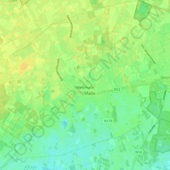
Name: Westmalle topographic map, elevation, terrain.
Location: Westmalle, Malle, Antwerpen, Vlaanderen, 2390, België (51.27250 4.63369 51.32684 4.71813)
Average elevation: 75 ft
Minimum elevation: 43 ft
Maximum elevation: 105 ft
Other topographic maps
Click on a map to view its topography, its elevation and its terrain.