Geolocate

Damortis topographic map

Click on the map to display elevation.

About this map
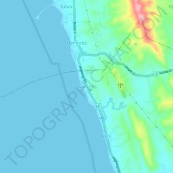
Name: Damortis topographic map, elevation, terrain.

Location: Damortis, Rosario, La Union, Ilocos Region, Philippines (16.21235 120.38728 16.25235 120.42728)

Average elevation: 69 ft

Minimum elevation: -3 ft

Maximum elevation: 505 ft

Gear up for your next adventure:

🏔️Mountain Trail Maps - High‑detail maps for popular peaks
🔦Powerful Headlamps - Ultra-bright hands-free lighting for night navigation
🧭Map Reading Tools - Tools and kits for map navigation
📦Gear Storage Bags - Organize and protect outdoor equipment
😴Insulated Sleeping Pads - Compact and warm pads for high-elevation camping

As an Amazon Associate, this site earns from qualifying purchases at no extra cost to you.