Geolocate

Inagawan topographic map

Click on the map to display elevation.

About this map

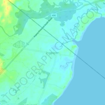
Name: Inagawan topographic map, elevation, terrain.

Location: Inagawan, Puerto Princesa, Palawan, Mimaropa, Philippines (9.52770 118.62528 9.56770 118.66528)

Average elevation: 16 ft

Minimum elevation: -10 ft

Maximum elevation: 79 ft

Gear up for your next adventure:

🔥Plasma Lighters - Windproof lighters that work in any weather condition
🔥Camping Stove - Portable stove for camping and backcountry cooking
📚USA Hiking Guide Books - Top trail guides and map books
🕶️Glacier Sunglasses - Side shields to protect eyes from high-altitude snow glare
🌲Outdoor Survival Books - Best books on survival skills

As an Amazon Associate, this site earns from qualifying purchases at no extra cost to you.