Geolocate

Chillihua topographic map

Click on the map to display elevation.

About this map

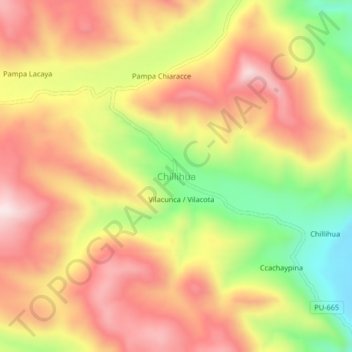
Name: Chillihua topographic map, elevation, terrain.

Location: Chillihua, Nuñoa, Province of Melgar, Puno, Peru (-14.31756 -70.86885 -14.27756 -70.82885)

Average elevation: 15,125 ft

Minimum elevation: 14,183 ft

Maximum elevation: 15,843 ft

Gear up for your next adventure:

🎒Trekking Poles - Sturdy poles for balance and stability on rough terrain
🧭Map Reading Tools - Tools and kits for map navigation
🧤Tactile Hiking Gloves - Keep hands warm while operating GPS and smartphone screens
🪶Multi‑Purpose Knife - Useful blade for camp and trail
🧦Hiking Socks - Comfortable socks to prevent blisters on long hikes

As an Amazon Associate, this site earns from qualifying purchases at no extra cost to you.