Geolocate

Boong-oco topographic map

Click on the map to display elevation.

About this map

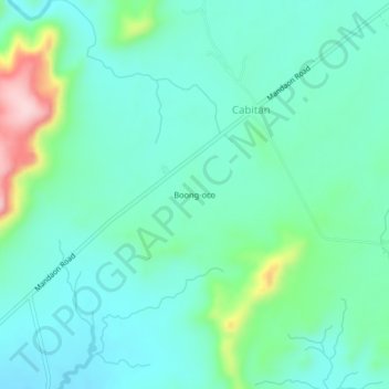
Name: Boong-oco topographic map, elevation, terrain.

Location: Boong-oco, Cabitan, Masbate, Bicol Region, Philippines (12.26753 123.31437 12.30753 123.35437)

Average elevation: 223 ft

Minimum elevation: 46 ft

Maximum elevation: 840 ft

Gear up for your next adventure:

📷Action Camera - Capture your outdoor adventures in HD
🔥Camping Stove - Portable stove for camping and backcountry cooking
🔌USB Car Charger - Car charger for on‑the‑go power needs
🪄Magnetic Compass - Accurate compass for navigation
🍳Camping Cook Set - Complete cookware for outdoor meals

As an Amazon Associate, this site earns from qualifying purchases at no extra cost to you.