Geolocate

Billing topographic map

Click on the map to display elevation.

About this map

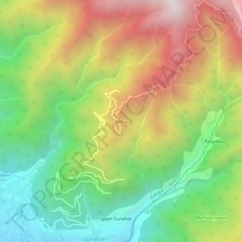
Name: Billing topographic map, elevation, terrain.

Location: Billing, Baijnath, Kangra, Himachal Pradesh, 176077, India (32.03843 76.72463 32.07843 76.76463)

Average elevation: 6,936 ft

Minimum elevation: 4,846 ft

Maximum elevation: 9,649 ft

Gear up for your next adventure:

⛑️Personal Locator Beacon - Safety beacon for emergencies
🧤Tactile Hiking Gloves - Keep hands warm while operating GPS and smartphone screens
🧯Emergency Survival Kit - All‑in‑one survival essentials for the backcountry
🦶Carbon Trekking Poles - Reduce knee impact on steep descents with ultra-light poles
🧣Merino Neck Gaiters - Multi-functional headwear for wind and sun protection

As an Amazon Associate, this site earns from qualifying purchases at no extra cost to you.