Geolocate

Tiny topographic map

Click on the map to display elevation.

About this map

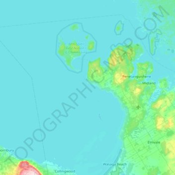
Name: Tiny topographic map, elevation, terrain.

Location: Tiny, Simcoe County, Central Ontario, Ontario, Canada (44.53155 -80.51594 44.94182 -79.82579)

Average elevation: 627 ft

Minimum elevation: 564 ft

Maximum elevation: 1,660 ft

Other topographic maps

Click on a map to view its topography, its elevation and its terrain.

Devils Glen

Canada > Ontario > Simcoe County > Clearview

Average elevation: 1,644 ft

Gear up for your next adventure:

🧤Hiking Gloves - Protective gloves for rugged trails
📻Weather Alert Radios - Stay informed of storm risks while off-the-grid
📖Nature Tracking Books - Learn to track wildlife and terrain
📷Action Cameras - Rugged cameras to document your journeys across rugged terrain
🔦Powerful Headlamps - Ultra-bright hands-free lighting for night navigation

As an Amazon Associate, this site earns from qualifying purchases at no extra cost to you.