
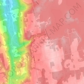
Eugenia topographic map
Interactive map
Click on the map to display elevation.
About this map
Name: Eugenia topographic map, elevation, terrain.
Average elevation: 1,339 ft
Minimum elevation: 906 ft
Maximum elevation: 1,493 ft
Other topographic maps
Click on a map to view its topography, its elevation and its terrain.
Maxwell
Canada > Ontario > Grey County > Grey Highlands
Maxwell, Grey Highlands, Grey County, Ontario, N0C 1J0, Canada
Average elevation: 1,594 ft
Markdale
Canada > Ontario > Grey County > Grey Highlands
Markdale, Grey Highlands, Grey County, Ontario, N0C 1H0, Canada
Average elevation: 1,381 ft
Eugenia Lake
Canada > Ontario > Grey County > Grey Highlands
Eugenia Lake, Grey Highlands, Grey County, Ontario, Canada
Average elevation: 1,444 ft
Flesherton
Canada > Ontario > Grey County > Grey Highlands
Flesherton, Grey Highlands, Grey County, Ontario, N0C 1E0, Canada
Average elevation: 1,470 ft
Eugenia Falls
Canada > Ontario > Grey County > Grey Highlands
Eugenia Falls, Grey Highlands, Grey County, Southwestern Ontario, Ontario, N0C 1E0, Canada
Average elevation: 1,302 ft
Singhampton
Canada > Ontario > Grey County > Grey Highlands
Singhampton, Grey Highlands, Grey County, Southwestern Ontario, Ontario, N0C 1M0, Canada
Average elevation: 1,660 ft
Kimberley
Canada > Ontario > Grey County > Grey Highlands
Kimberley, Grey Highlands, Grey County, Ontario, Canada
Average elevation: 1,109 ft
Feversham
Canada > Ontario > Grey County > Grey Highlands
Feversham, Grey Highlands, Grey County, Ontario, N0C 1J0, Canada
Average elevation: 1,608 ft