
Thank you for supporting this site ❤️
Make a donation
Make a donation
Gear up for your next adventure:
As an Amazon Associate, this site earns from qualifying purchases at no extra cost to you.
Udu-ri topographic map
Click on the map to display elevation.
Thank you for supporting this site ❤️
Make a donation
Make a donation
Gear up for your next adventure:
As an Amazon Associate, this site earns from qualifying purchases at no extra cost to you.
About this map
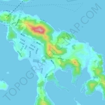
Name: Udu-ri topographic map, elevation, terrain.
Location: Udu-ri, Yeosu-si, South Jeolla, 59769, South Korea (34.69738 127.74284 34.73738 127.78284)
Average elevation: 52 ft
Minimum elevation: -10 ft
Maximum elevation: 587 ft
Thank you for supporting this site ❤️
Make a donation
Make a donation
Gear up for your next adventure:
As an Amazon Associate, this site earns from qualifying purchases at no extra cost to you.