Geolocate

Cuba topographic map

Click on the map to display elevation.

About this map

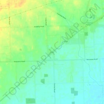
Name: Cuba topographic map, elevation, terrain.

Location: Cuba, Allen County, Indiana, 46741, United States (41.16564 -84.95841 41.20564 -84.91841)

Average elevation: 784 ft

Minimum elevation: 748 ft

Maximum elevation: 837 ft

Allen County trails, hiking, mountain biking, running and outdoor activities

Other topographic maps

Click on a map to view its topography, its elevation and its terrain.

Leo-Cedarville

United States > Indiana > Allen County

Average elevation: 804 ft

Monroeville

United States > Indiana > Allen County

Average elevation: 794 ft

Woodburn

United States > Indiana > Allen County

Average elevation: 748 ft

New Haven

United States > Indiana > Allen County

Average elevation: 778 ft

Gear up for your next adventure:

👟Trail Running Shoes - Lightweight shoes for trail runners
🦺Reflective Outdoor Gear - Safety gear for low‑light conditions
💧Water Filtration Bottles - Safely drink from streams and lakes while exploring
🧥Waterproof Jacket for Hiking - Breathable and rugged rain jacket for outdoor excursions
📶Satellite Messenger - Communication device off‑grid

As an Amazon Associate, this site earns from qualifying purchases at no extra cost to you.