
Sainte-Rose-de-Watford topographic map
Interactive map
Click on the map to display elevation.
About this map
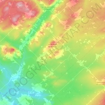
Name: Sainte-Rose-de-Watford topographic map, elevation, terrain.
Average elevation: 1,214 ft
Minimum elevation: 932 ft
Maximum elevation: 1,634 ft
Other topographic maps
Click on a map to view its topography, its elevation and its terrain.
Saint-Camille-de-Lellis
Canada > Quebec > Les Etchemins > Saint-Camille-de-Lellis
Saint-Camille-de-Lellis, Les Etchemins, Chaudiere-Appalaches, Quebec, Canada
Average elevation: 1,335 ft