
Iron Belt topographic map
Interactive map
Click on the map to display elevation.
About this map
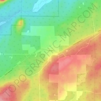
Name: Iron Belt topographic map, elevation, terrain.
Average elevation: 1,558 ft
Minimum elevation: 1,375 ft
Maximum elevation: 1,752 ft
Other topographic maps
Click on a map to view its topography, its elevation and its terrain.
Montreal
United States > Wisconsin > Iron County
Montreal, Iron County, Wisconsin, United States
Average elevation: 1,522 ft
Town of Gurney
United States > Wisconsin > Iron County
Town of Gurney, Iron County, Wisconsin, United States
Average elevation: 1,043 ft
Powell
United States > Wisconsin > Iron County
Powell, Town of Sherman, Iron County, Wisconsin, United States
Average elevation: 1,598 ft
Town of Pence
United States > Wisconsin > Iron County
Town of Pence, Iron County, Wisconsin, United States
Average elevation: 1,591 ft
Saxon
United States > Wisconsin > Iron County
Saxon, Town of Saxon, Iron County, Wisconsin, 54559, United States
Average elevation: 1,112 ft
Payment Lake
United States > Wisconsin > Iron County > Town of Mercer
Payment Lake, Town of Mercer, Iron County, Wisconsin, United States
Average elevation: 1,624 ft
Upson
United States > Wisconsin > Iron County
Upson, Town of Anderson, Iron County, Wisconsin, United States
Average elevation: 1,516 ft
Hurley
United States > Wisconsin > Iron County
Hurley, Iron County, Wisconsin, United States
Average elevation: 1,493 ft
Town of Anderson
United States > Wisconsin > Iron County
Town of Anderson, Iron County, Wisconsin, United States
Average elevation: 1,532 ft
Town of Mercer
United States > Wisconsin > Iron County
Town of Mercer, Iron County, Wisconsin, 54547, United States
Average elevation: 1,617 ft
Manitowish River
United States > Wisconsin > Iron County > Town of Mercer > Manitowish
Manitowish River, Manitowish, Town of Mercer, Iron County, Wisconsin, United States
Average elevation: 1,594 ft