Geolocate

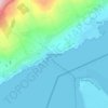
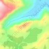
Lisfannan topographic map

Click on the map to display elevation.

About this map

Name: Lisfannan topographic map, elevation, terrain.

Location: Lisfannan, Burt ED, Inishowen Municipal District, County Donegal, Ireland (55.03084 -7.41757 55.04919 -7.38695)

Average elevation: 157 ft

Minimum elevation: -10 ft

Maximum elevation: 659 ft

Other topographic maps

Click on a map to view its topography, its elevation and its terrain.
Donegal

Ireland > County Donegal > Donegal

Average elevation: 157 ft

Newtown Cunningham

Ireland > County Donegal

Average elevation: 82 ft

Greencastle

Ireland > County Donegal

Average elevation: 151 ft

Portsalon

Ireland > County Donegal > Letterkenny

Average elevation: 89 ft

Mamore Gap

Ireland > County Donegal

Average elevation: 630 ft

Fintown

Ireland > County Donegal

Average elevation: 614 ft

Cashel

Ireland > County Donegal

Average elevation: 354 ft

Carndonagh

Ireland > County Donegal > Carndonagh

Average elevation: 256 ft

Maum

Ireland > County Donegal

Average elevation: 587 ft

Gear up for your next adventure:

🌡️Portable Weather Meter - Track weather conditions on the trail
😴Insulated Sleeping Pads - Compact and warm pads for high-elevation camping
💧Water Purification System - Clean water on the trail with reliable purifiers
💧Water Filtration Bottles - Safely drink from streams and lakes while exploring
🪶Compact Camp Shovel - Folding shovel for campsite tasks

As an Amazon Associate, this site earns from qualifying purchases at no extra cost to you.