Geolocate

Monte Rosa Massif topographic map

Click on the map to display elevation.

About this map

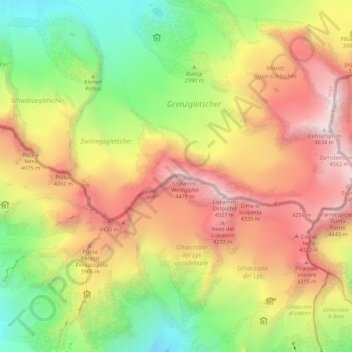
Name: Monte Rosa Massif topographic map, elevation, terrain.

Location: Monte Rosa Massif, Gressoney-La-Trinité, Aosta Valley, Italy (45.91665 7.76650 45.93695 7.87627)

Average elevation: 11,411 ft

Minimum elevation: 7,956 ft

Maximum elevation: 15,154 ft

Gear up for your next adventure:

🏥Hiking First Aid Kits - Comprehensive medical kits for remote trail injuries
🗺️NatGeo Topo Maps - High-quality waterproof printed topographic maps of US Parks
🎒Day Hiking Backpack - Lightweight backpack perfect for day trips and outdoor adventures
👟Trail Running Shoes - Lightweight shoes for trail runners
🔭Telescopic Hiking Pole - Adjustable pole for hiking stability

As an Amazon Associate, this site earns from qualifying purchases at no extra cost to you.