
Upper New Horton topographic map
Interactive map
Click on the map to display elevation.
About this map
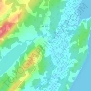
Name: Upper New Horton topographic map, elevation, terrain.
Average elevation: 66 ft
Minimum elevation: -3 ft
Maximum elevation: 262 ft
Other topographic maps
Click on a map to view its topography, its elevation and its terrain.
Harvey
Canada > New Brunswick > Harvey Parish
Harvey, Harvey Parish, Albert County, New Brunswick, E4H 4C1, Canada
Average elevation: 98 ft
Waterside
Canada > New Brunswick > Harvey Parish
Waterside, Harvey Parish, Albert County, New Brunswick, Canada
Average elevation: 66 ft