Geolocate

Manta topographic map

Click on the map to display elevation.

About this map

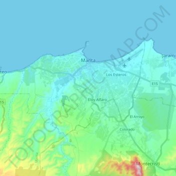
Name: Manta topographic map, elevation, terrain.

Location: Manta, Manabí, Ecuador (-1.02264 -80.83747 -0.92891 -80.66398)

Average elevation: 253 ft

Minimum elevation: -7 ft

Maximum elevation: 1,969 ft

Gear up for your next adventure:

Backpacking Tents - Weight-optimized shelters for multi-day topographic surveys
🌄Hiking Binoculars - Compact binoculars for scenic views and trail spotting
🪶Camping Sleeping Pad - Comfortable sleeping pad for backpacking
🏕️Family Camping Gear - Essentials for group camping trips
🥇GPS Hiking Watch - Multi‑sport GPS watch with navigation and trail tracking

As an Amazon Associate, this site earns from qualifying purchases at no extra cost to you.