
Thank you for supporting this site ❤️
Make a donation
Make a donation
Gear up for your next adventure:
As an Amazon Associate, this site earns from qualifying purchases at no extra cost to you.
Kocataş topographic map
Click on the map to display elevation.
Thank you for supporting this site ❤️
Make a donation
Make a donation
Gear up for your next adventure:
As an Amazon Associate, this site earns from qualifying purchases at no extra cost to you.
About this map
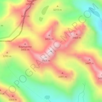
Name: Kocataş topographic map, elevation, terrain.
Location: Kocataş, İspir, Erzurum, Eastern Anatolia Region, Turkey (40.74014 40.98257 40.74024 40.98267)
Average elevation: 10,531 ft
Minimum elevation: 9,367 ft
Maximum elevation: 11,660 ft
Thank you for supporting this site ❤️
Make a donation
Make a donation
Gear up for your next adventure:
As an Amazon Associate, this site earns from qualifying purchases at no extra cost to you.